
 |
 |
|
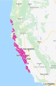
Distribution of Phytophthora ramorum in wildlands in California and Southern Oregon, 2021. Credit: Garbelotto, CALINVASIVES |
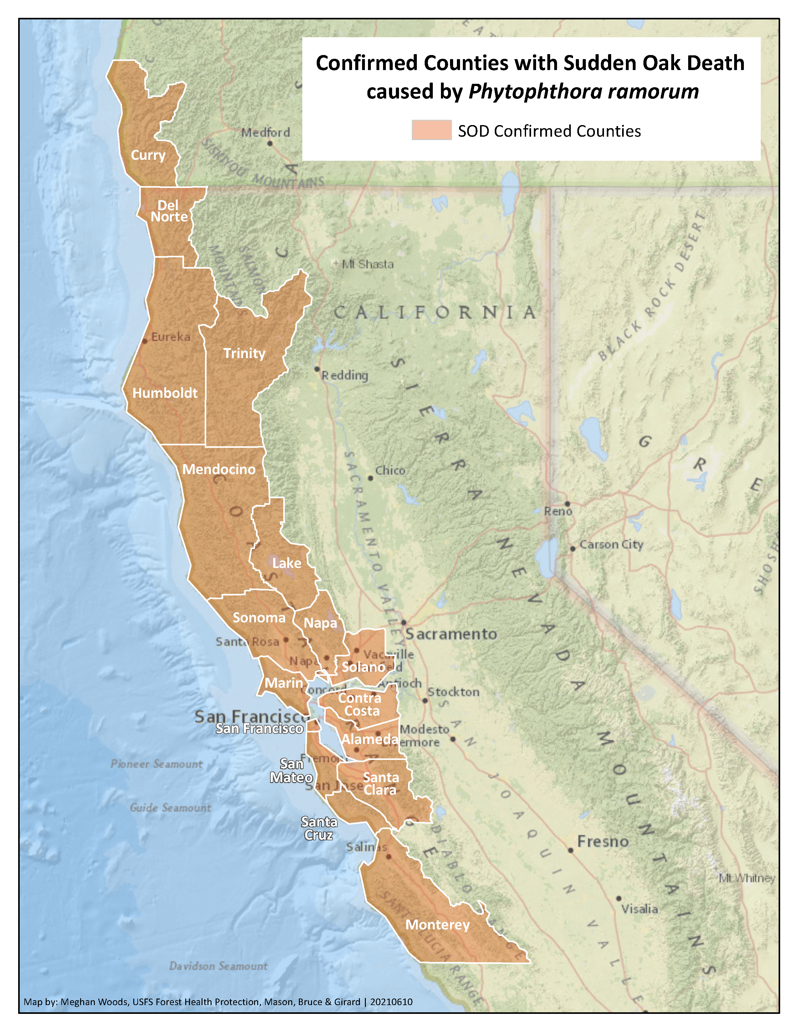
Map of confirmed counties with Sudden Oak Death caused by Phytophthora ramorum in Northern California |
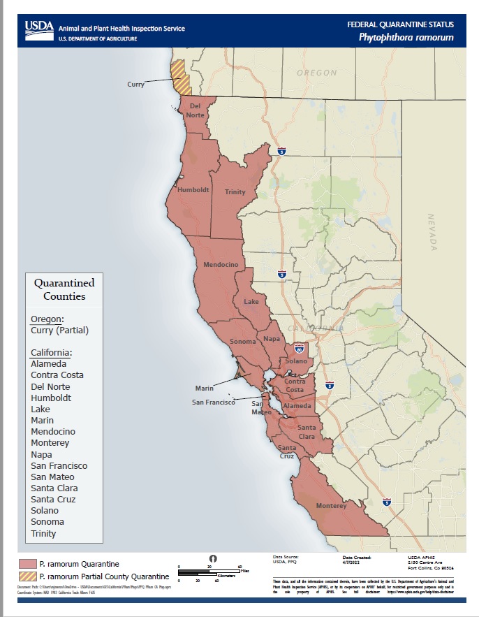 Download PPQ P. ramorum Quarantine Map (April 2022)
Links to updated (late 2019) county maps displaying known, confirmed trees infected by P. ramorum, based on SODMap (UC Berkeley, Garbelotto lab):
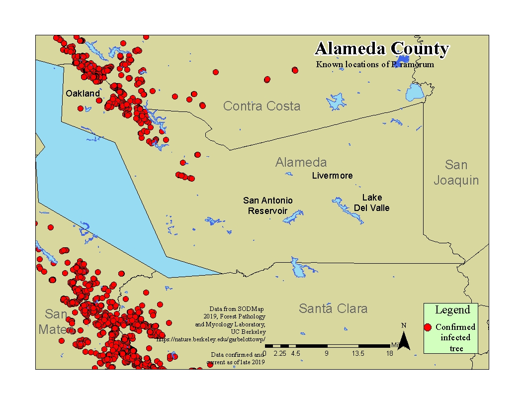 Alameda County Alameda County |
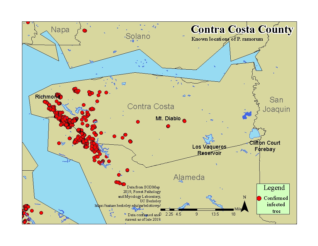 Contra Costa County Contra Costa County |
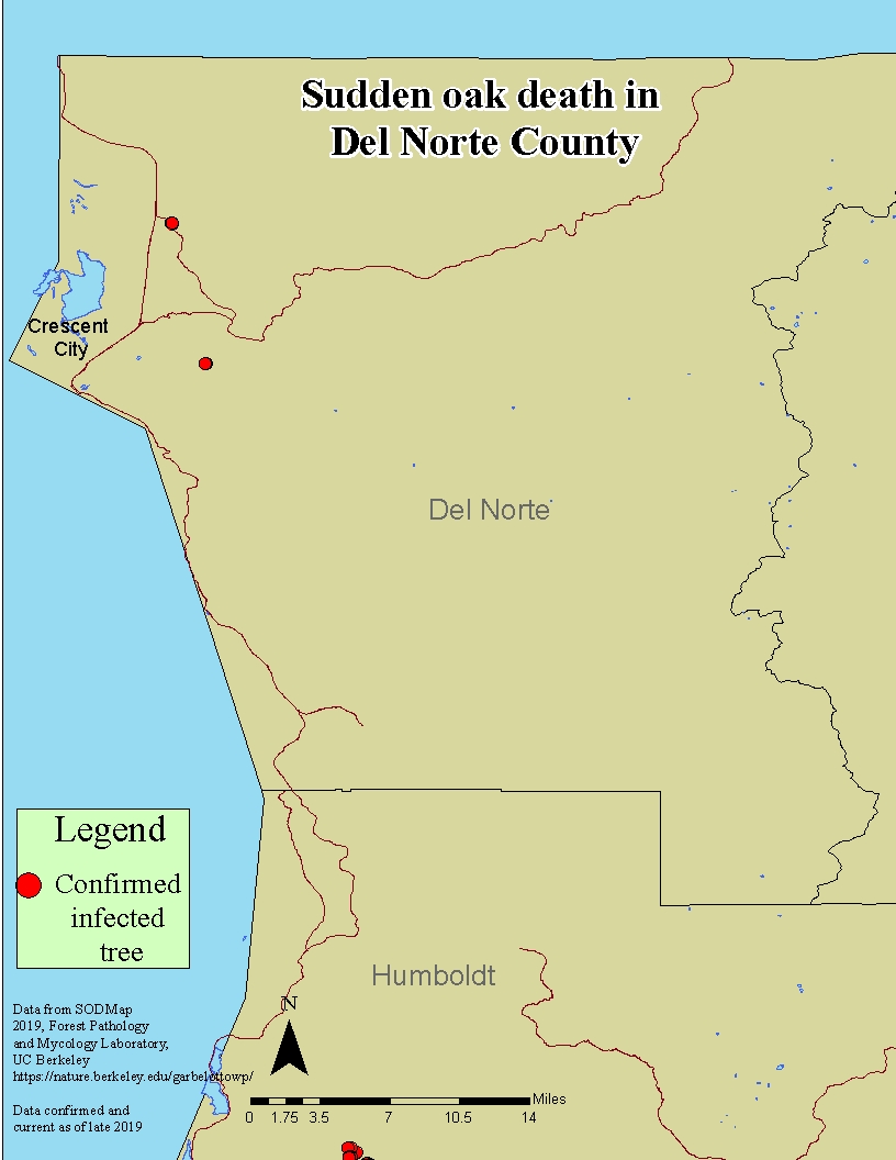 Del Norte County Del Norte County |
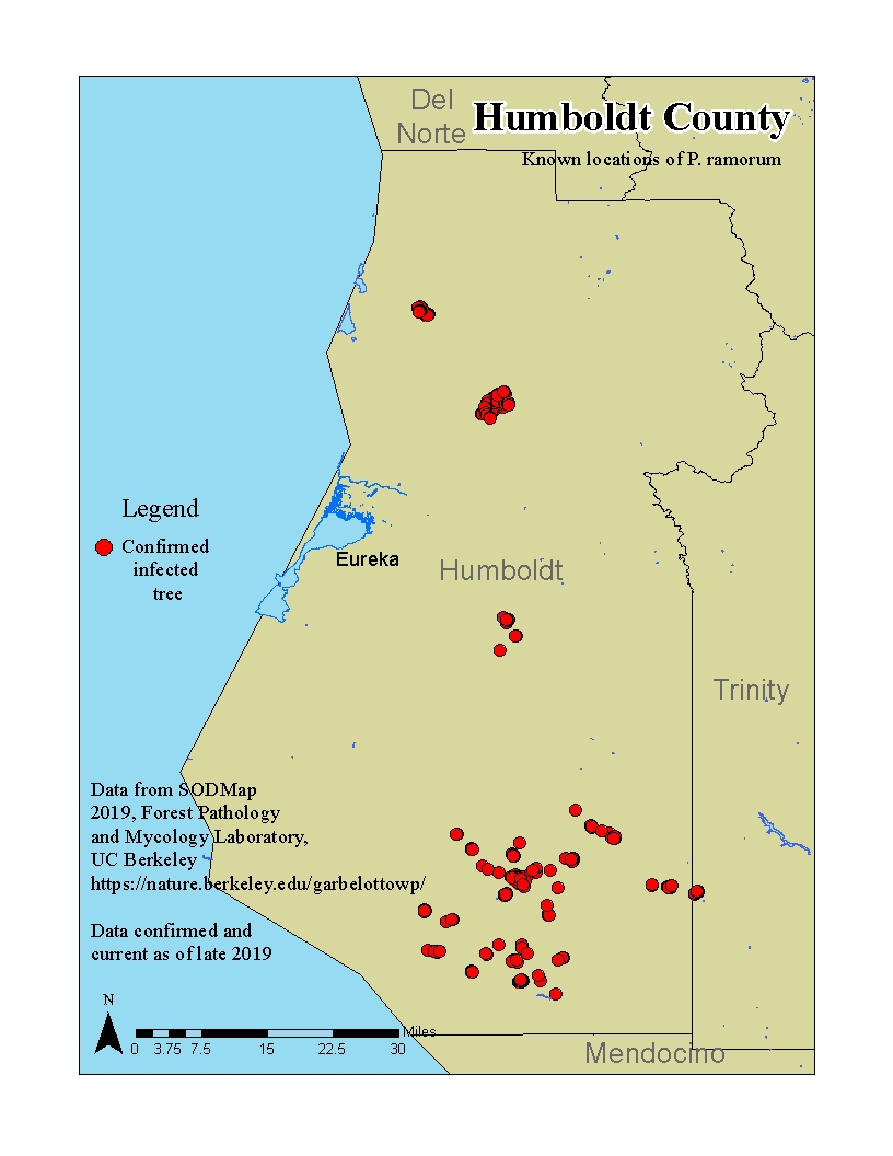 Humboldt County Humboldt County |
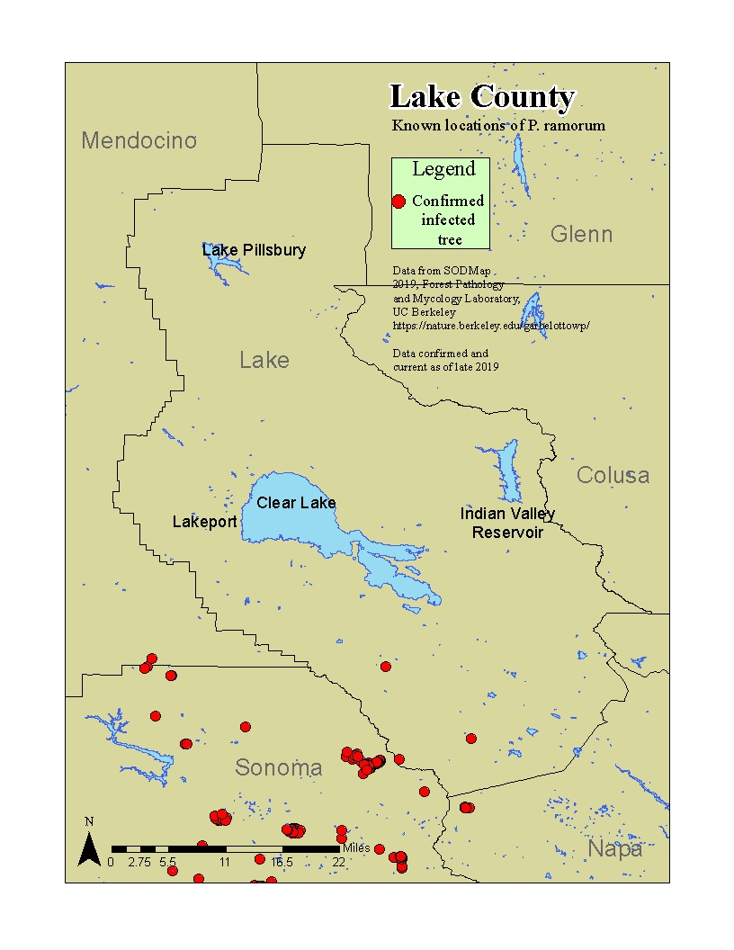 Lake County Lake County |
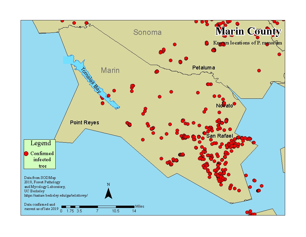 Marin County Marin County |
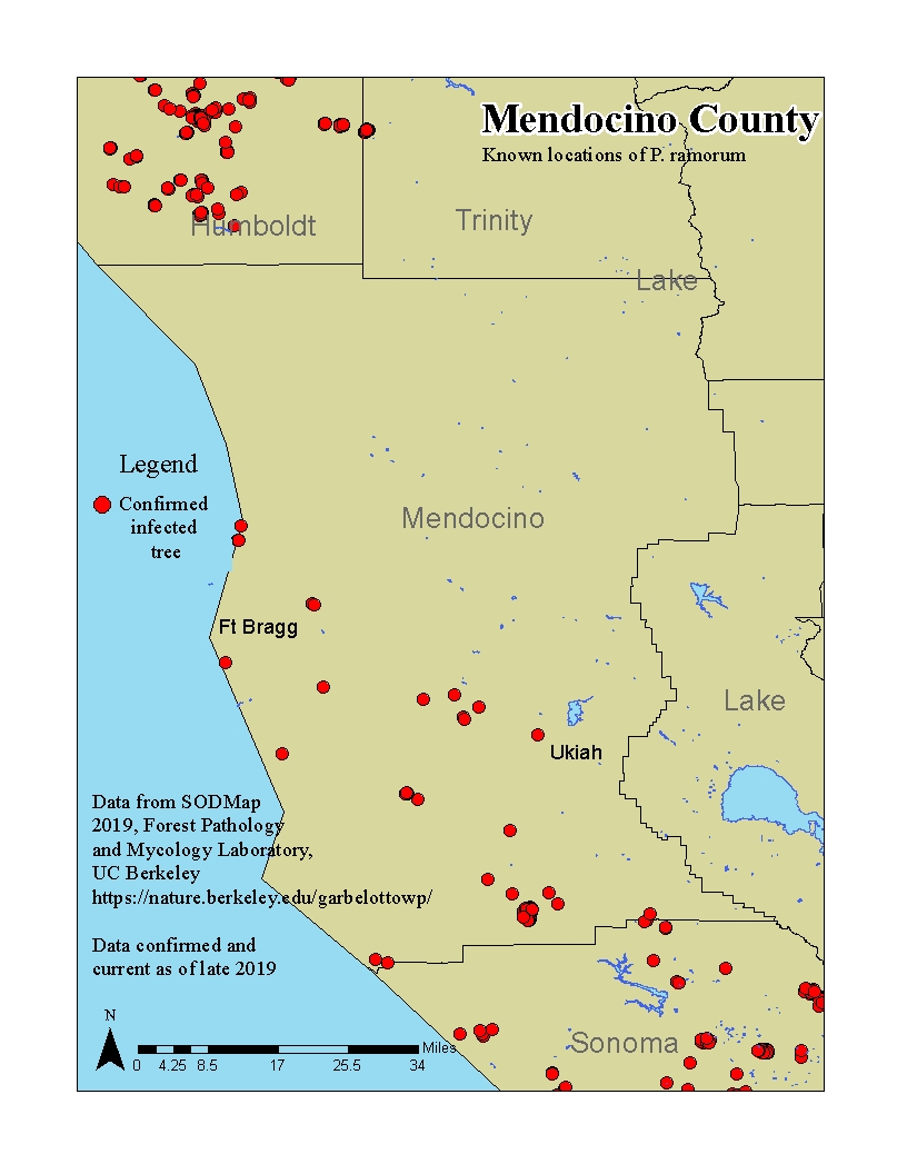 Mendocino County Mendocino County |
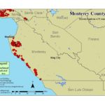 Monterey County Monterey County |
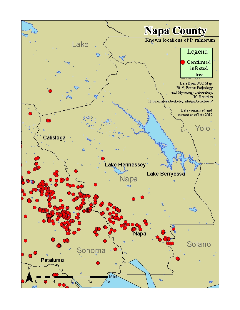 Napa County Napa County |
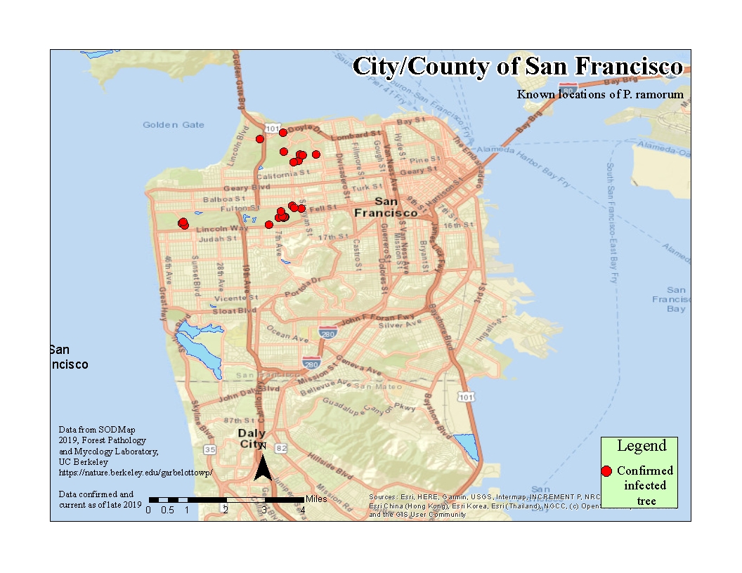 San Francisco County San Francisco County |
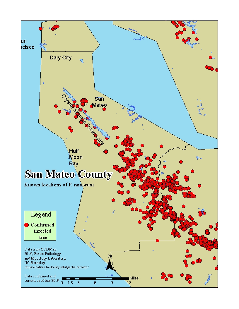 San Mateo County San Mateo County |
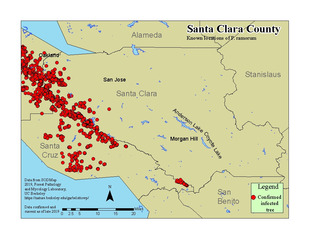 Santa Clara County Santa Clara County |
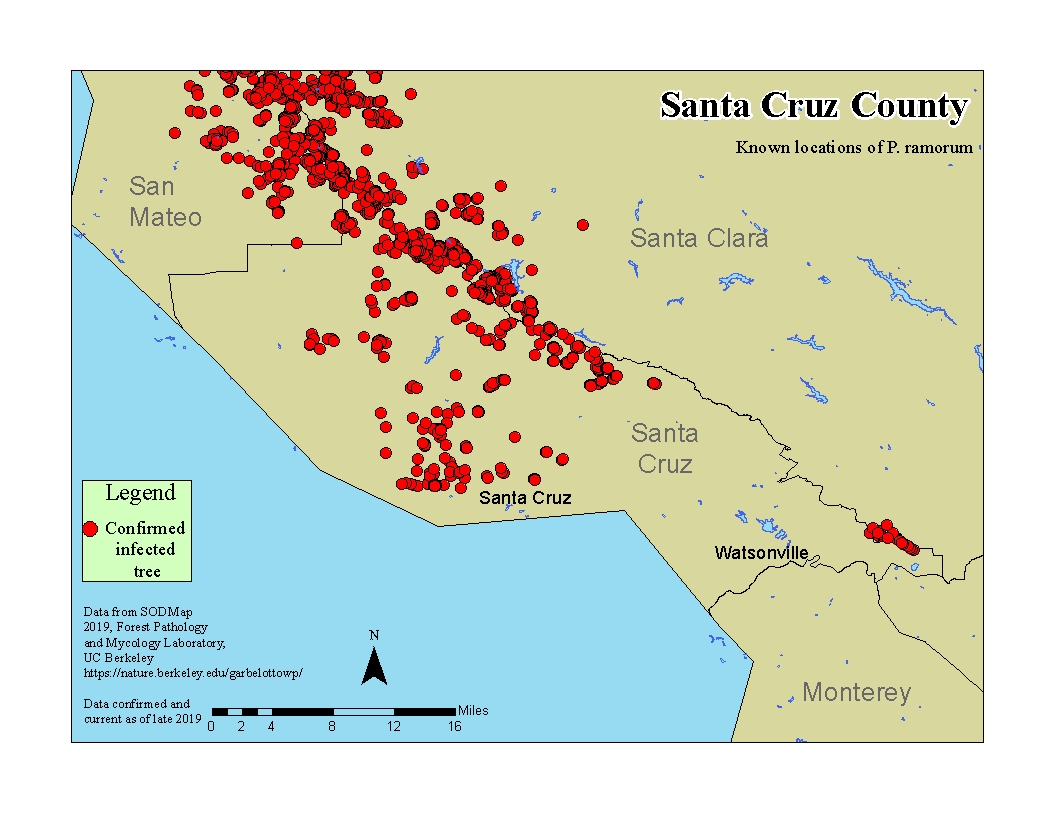 Santa Cruz County Santa Cruz County |
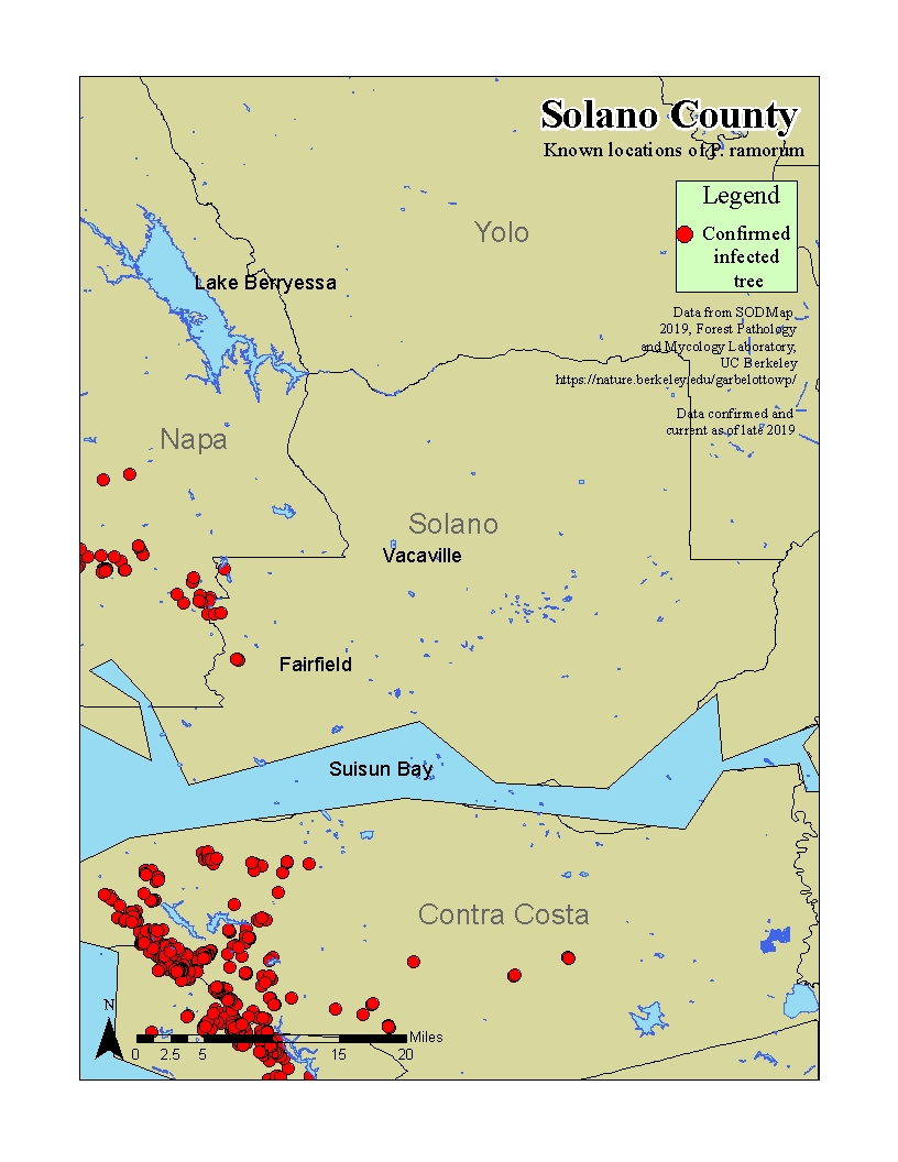 Solano County Solano County |
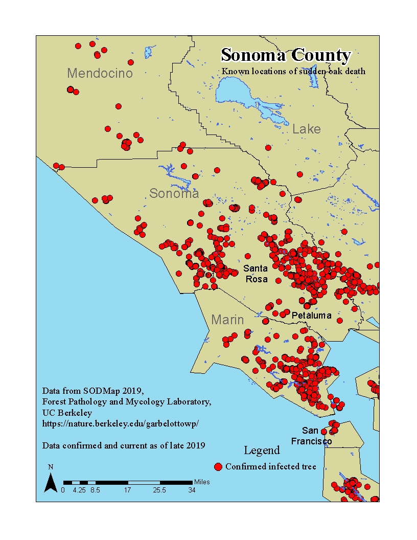 Sonoma County Sonoma County |
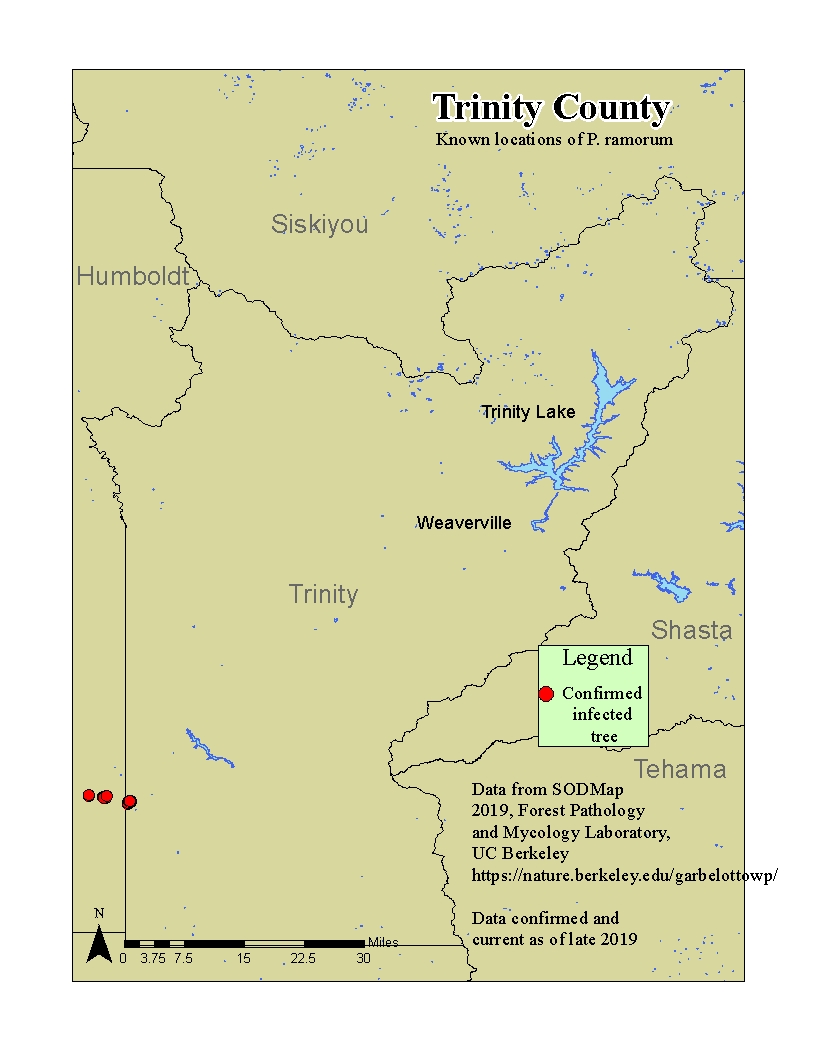 Trinity County Trinity County |
**Note that the maps provide a general idea of pathogen distribution in wildlands but not every record is displayed.

SODMAP includes P. ramorum reports confirmed by an official laboratory, including negative findings, with the intention of sharing known distribution information gathered by public agencies and research groups across the country.

The Oakmapper site provided a GIS tool which allowed users to learn about P. ramorum distribution in California. The online site was taken down in fall 2017 but the data files are available for download and use in your own GIS program. Download a zip file that contains the Officially Confirmed and Community Submitted shapefiles here.
Risk Maps
Video of projected Phytophthora ramorum spread in California from Meentemeyer, R. K.; Cunniffe, N. J.; Cook, A.R.; Filipe, J.A. and others. 2011. Epidemiological modeling of invasion in heterogeneous landscapes: spread of sudden oak death in California (1990-2030). Ecosphere. 2(2): 1-24.